![](/images/other/stat-length.png)
Saint-Julien-près-Bort
houbart
User
![Length](/images/other/stat-length.png)
Length
5.1 km
![Max alt](https://static1.geolcdn.com/siteimages/upload/files/1508320355ic_sort_altitude_max_24dp.png)
Max alt
619 m
![Uphill gradient](https://static1.geolcdn.com/siteimages/upload/files/1508320355ic_sort_den_pos_24dp.png)
Uphill gradient
86 m
![Km-Effort](/images/other/stat-length.png)
Km-Effort
6.3 km
![Min alt](https://static1.geolcdn.com/siteimages/upload/files/1508320355ic_sort_altitude_min_24dp.png)
Min alt
571 m
![Downhill gradient](https://static1.geolcdn.com/siteimages/upload/files/1508320355ic_sort_den_neg_24dp.png)
Downhill gradient
85 m
![Boucle](https://static1.geolcdn.com/siteimages/upload/files/16400158638029165_repeat_loop_refresh_sync_direction_icon.png)
Boucle
Yes
Creation date :
2019-03-28 15:47:32.054
Updated on :
2019-03-28 15:47:32.11
![Walking](https://static1.geolcdn.com/sitytour/trail-icons/101.png)
1h23
Difficulty : Easy
![Scan this QR Code to open this trail in the SityTrail application](https://capi.geolives.com/qq0zvz2zws4bq2lad0pu/sitytour/trails/422568/qr.png?size=200)
FREE GPS app for hiking
About
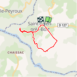
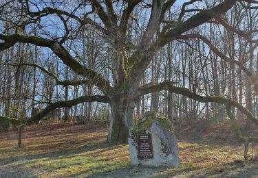
Trail Walking of 5.1 km to be discovered at New Aquitaine, Corrèze, Sarroux - Saint-Julien. This trail is proposed by houbart.
Description
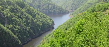
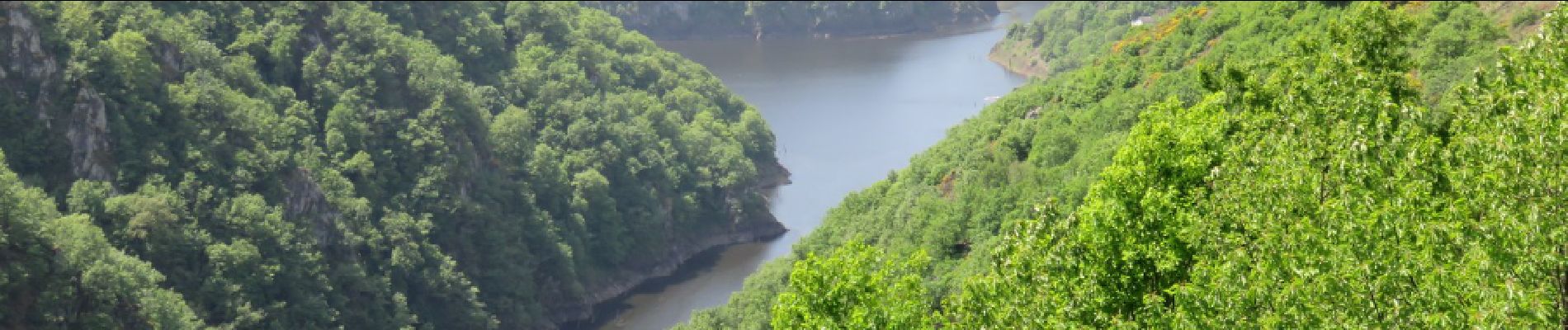
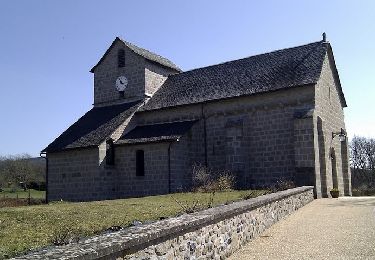
Départ devant l'église. Accès au site de Saint-Nazaire qui offre un panorama exceptionnel sur les gorges de la Dordogne et de la Diège. C'est une zone d'intérêt écologique, faunistique et floristique.
Positioning
Country:
France
Region :
New Aquitaine
Department/Province :
Corrèze
Municipality :
Sarroux - Saint-Julien
Location:
Saint-Julien-près-Bort
Start:(Dec)
Start:(UTM)
453326 ; 5029301 (31T) N.
Comments
Trails nearby
![Trail Walking Sarroux - Saint-Julien - Un air de montagne - Sarroux - Photo](https://media.geolcdn.com/t/375/260/ext.jpg?maxdim=2&url=https%3A%2F%2Fservices.sitytrail.com%2FGeolivesWS%2FDownloadMedia.ashx%3FTrailID%3D318091%26Media%3D17549_2.jpg)
![Walking Walking](https://static1.geolcdn.com/sitytour/trail-icons/101.png)
Un air de montagne - Sarroux
Walking
Medium
(1)
Sarroux - Saint-Julien,
New Aquitaine,
Corrèze,
France
![](/images/other/stat-length.png)
16 km | 21 km-effort
4h 30min
![](https://static1.geolcdn.com/siteimages/upload/files/16400158638029165_repeat_loop_refresh_sync_direction_icon.png)
Yes
![Trail Walking Sarroux - Saint-Julien - La Pyramide, le château Pierrefitte, les Orgues - Photo](https://media.geolcdn.com/t/375/260/ext.jpg?maxdim=2&url=https%3A%2F%2Fstatic1.geolcdn.com%2Fsiteimages%2Fupload%2Ffiles%2F1553511878bg_sport_marche.png)
![Walking Walking](https://static1.geolcdn.com/sitytour/trail-icons/101.png)
La Pyramide, le château Pierrefitte, les Orgues
Walking
Easy
(2)
Sarroux - Saint-Julien,
New Aquitaine,
Corrèze,
France
![](/images/other/stat-length.png)
15.6 km | 23 km-effort
4h 28min
![](https://static1.geolcdn.com/siteimages/upload/files/16400158638029165_repeat_loop_refresh_sync_direction_icon.png)
Yes
![Trail Walking Sarroux - Saint-Julien - le site de Saint-Nazaire - Photo](https://media.geolcdn.com/t/375/260/5f0b677a-852b-4fdc-8074-c6913b286b71.jpg&format=jpg&maxdim=2)
![Walking Walking](https://static1.geolcdn.com/sitytour/trail-icons/101.png)
le site de Saint-Nazaire
Walking
Easy
(1)
Sarroux - Saint-Julien,
New Aquitaine,
Corrèze,
France
![](/images/other/stat-length.png)
14.2 km | 17.6 km-effort
5h 36min
![](https://static1.geolcdn.com/siteimages/upload/files/16400158638029165_repeat_loop_refresh_sync_direction_icon.png)
Yes
![Trail Walking Margerides - margerides Fred B C - Photo](https://media.geolcdn.com/t/375/260/ext.jpg?maxdim=2&url=https%3A%2F%2Fstatic1.geolcdn.com%2Fsiteimages%2Fupload%2Ffiles%2F1553511878bg_sport_marche.png)
![Walking Walking](https://static1.geolcdn.com/sitytour/trail-icons/101.png)
margerides Fred B C
Walking
Medium
Margerides,
New Aquitaine,
Corrèze,
France
![](/images/other/stat-length.png)
9 km | 11.7 km-effort
2h 39min
![](https://static1.geolcdn.com/siteimages/upload/files/16400158638029165_repeat_loop_refresh_sync_direction_icon.png)
Yes
![Trail Walking Sarroux - Saint-Julien - E 4 Lagrange_Roche le Peyroux. - Photo](https://media.geolcdn.com/t/375/260/ext.jpg?maxdim=2&url=https%3A%2F%2Fstatic1.geolcdn.com%2Fsiteimages%2Fupload%2Ffiles%2F1553511878bg_sport_marche.png)
![Walking Walking](https://static1.geolcdn.com/sitytour/trail-icons/101.png)
E 4 Lagrange_Roche le Peyroux.
Walking
Difficult
Sarroux - Saint-Julien,
New Aquitaine,
Corrèze,
France
![](/images/other/stat-length.png)
13.6 km | 18.1 km-effort
4h 7min
![](https://static1.geolcdn.com/siteimages/upload/files/16400158638029165_repeat_loop_refresh_sync_direction_icon.png)
No
![Trail Walking Sarroux - Saint-Julien - Dordogne saint Julien près de Bort - Photo](https://media.geolcdn.com/t/375/260/ext.jpg?maxdim=2&url=https%3A%2F%2Fstatic1.geolcdn.com%2Fsiteimages%2Fupload%2Ffiles%2F1553511878bg_sport_marche.png)
![Walking Walking](https://static1.geolcdn.com/sitytour/trail-icons/101.png)
Dordogne saint Julien près de Bort
Walking
Difficult
Sarroux - Saint-Julien,
New Aquitaine,
Corrèze,
France
![](/images/other/stat-length.png)
11.9 km | 14.8 km-effort
3h 6min
![](https://static1.geolcdn.com/siteimages/upload/files/16400158638029165_repeat_loop_refresh_sync_direction_icon.png)
Yes
![Trail Walking Roche-le-Peyroux - Itinereve 2 - Photo](https://media.geolcdn.com/t/375/260/ext.jpg?maxdim=2&url=https%3A%2F%2Fstatic1.geolcdn.com%2Fsiteimages%2Fupload%2Ffiles%2F1553511878bg_sport_marche.png)
![Walking Walking](https://static1.geolcdn.com/sitytour/trail-icons/101.png)
Itinereve 2
Walking
Very difficult
Roche-le-Peyroux,
New Aquitaine,
Corrèze,
France
![](/images/other/stat-length.png)
45 km | 59 km-effort
9h 0min
![](https://static1.geolcdn.com/siteimages/upload/files/16400158638029165_repeat_loop_refresh_sync_direction_icon.png)
No
![Trail Walking Saint-Pierre - st Pierre - Photo](https://media.geolcdn.com/t/375/260/ext.jpg?maxdim=2&url=https%3A%2F%2Fstatic1.geolcdn.com%2Fsiteimages%2Fupload%2Ffiles%2F1553511878bg_sport_marche.png)
![Walking Walking](https://static1.geolcdn.com/sitytour/trail-icons/101.png)
st Pierre
Walking
Easy
Saint-Pierre,
Auvergne-Rhône-Alpes,
Cantal,
France
![](/images/other/stat-length.png)
8.2 km | 10.9 km-effort
2h 22min
![](https://static1.geolcdn.com/siteimages/upload/files/16400158638029165_repeat_loop_refresh_sync_direction_icon.png)
Yes
![Trail Road bike Liginiac - Vélo Serandon - Lac - Photo](https://media.geolcdn.com/t/375/260/ext.jpg?maxdim=2&url=https%3A%2F%2Fstatic1.geolcdn.com%2Fsiteimages%2Fupload%2Ffiles%2F1524743154velo.jpg)
![Road bike Road bike](https://static1.geolcdn.com/sitytour/trail-icons/201.png)
Vélo Serandon - Lac
Road bike
Easy
Liginiac,
New Aquitaine,
Corrèze,
France
![](/images/other/stat-length.png)
20 km | 25 km-effort
1h 30min
![](https://static1.geolcdn.com/siteimages/upload/files/16400158638029165_repeat_loop_refresh_sync_direction_icon.png)
Yes